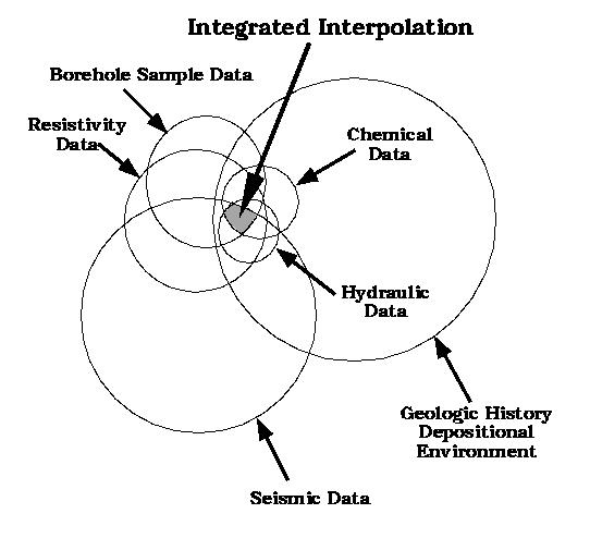
Figure 1.6: Interpretation of each set of data reveals a range of possible subsurface configurations. When the data are integrated, only the subsurface configurations which are possible interpretations of all the data remain as possible interpretations of the site. Each data set that is added to the integrated interpretation further reduces the zone of overlap, thus reducing the overall uncertainty.